
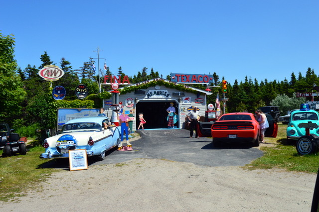
We left our campground on the central western coast late after making many phone calls about our water pump problem. Winnebago confirmed my suspicion that the fault is probably a simple valve on our water intake and we have it all set up to be repaired on Monday. We stopped in the major town of Corner Brook to do some shopping and stopped for a campsite in Barachois Pond Provincial Park. No hookups, but being on the lake was wonderful, except the black flies found me and now my face looks like I have hives all over. Jack has no bites. Hmmm.
 |
| Campsite path to water where we enjoyed a cocktail |
Next morning, we drove on the central western coast and headed south. We stopped and toured the Codroy Valley loop - one of the few agricultural areas of Newfoundland. We even saw some grazing cows - rare, here. Lots of granite mountains mostly covered in deep green pine trees.
 |
| Cannot go further west! |
We drove to Cape Anguille, the westernmost point on Newfoundland. We stopped among the wildflowers overlooking the ocean for lunch and a quick nap. There is a lighthouse and the former lightkeeper's house is now a small Inn. I am not quite sure what a self-catered breakfast is in their brochure, but I assume it is bring your own!
 |
| Cape Anguille Lighthouse |
 |
| Formerly the Lightkeeper's House, now an Inn |
We also stopped at the Wetlands Interpretation Centre on an estuary, but apparently the birds only visit during spring and fall migration because there were none when we were there. Some interesting roadside art on these side roads...
 |
| Fishermen use the church steeples to locate their favorite fishing spots |
 |
Add caption |
 |
| We would have stopped to visit this "museum" but no place to park for us |
We continued south and made a quick detour to check out Cape Ray where Dorset paleo-Eskimo artifacts were discovered. A pretty lighthouse and sandy beach were good photo ops.
 |
| Pretty public beach with not a soul on this beautiful day |
We tried to get a campsite at J. T. Cheeseman Provincial Park, but no electric sites were available. From my research, I knew of a place to stay overnight overlooking the ocean for free - so why pay for a spot when we can get a better site at no cost!
So, we continued to the southernmost point and then headed east along the southern coast to the end of the road at Rose Blanche. We stopped at Hairyman Cafe for their famous scalded buns, made with pork fat and currants - delicious. The name of the restaurant is not as gross as it sounds....this southern coast is the site of many wrecks - as many as 40 major ships just off one town appropriately named Isle aux Morts (Isle of the Dead). In the 1820's, a local man with his family and dog saved almost everyone aboard a sinking vessel by tying fishing nets together and making a lifeline to shore. Somehow, their dog, Hairyman, was involved, but I have yet to find out how. Anyway, the family and their Newfoundland dog, Hairyman, are heroes with many things named after them.
Rose Blanche is famous for its unique lighthouse built of granite high atop the boulders. I walked out to the overlook and toured the lighthouse.
 |
| RV center of photo - our free campsite with the ocean to the right |
I double checked with the office about staying at the picnic spot overlooking the sea right next to the lighthouse area and they said "sure."
We spent a beautiful, quiet night watching the waves crashing on the boulders and woke to blue skies.

We drove leisurely back along the same road, stopping to visit a couple of small fishing villages. Many of these small towns consist of very dilapidated old houses and modern-looking prefabs. We were told the newish homes are the result of former cod fishermen in remote small fishing villages relocating to towns that had roads, electricity and access to jobs.
 |
| Town of Burnt Islands |
 |
| Rose Blanche |
We hiked to a nice waterfall along a path going through the arctic type barrens and a bog with carnivorous plants.
 |
| Carnivorous Plant |
 |
| Carnivorous Plant |
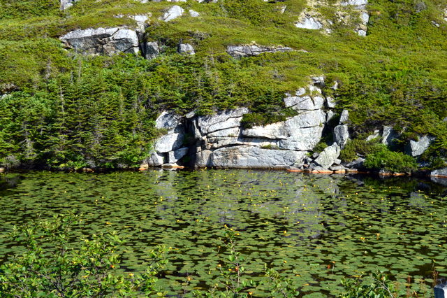
This are of Newfoundland is beautiful country - great, hulking granite boulders with small deep blue fresh water ponds with water lilies one one side and the ocean (technically Cabot Strait) on the other.
We returned north up the coast and got a campsite with electric, cellphone service and internet - first time in two days so we can recharge electronics and camera batteries and check email and update the blog.
 We left our campground on the central western coast late after making many phone calls about our water pump problem. Winnebago confirmed my suspicion that the fault is probably a simple valve on our water intake and we have it all set up to be repaired on Monday. We stopped in the major town of Corner Brook to do some shopping and stopped for a campsite in Barachois Pond Provincial Park. No hookups, but being on the lake was wonderful, except the black flies found me and now my face looks like I have hives all over. Jack has no bites. Hmmm.


 We drove leisurely back along the same road, stopping to visit a couple of small fishing villages. Many of these small towns consist of very dilapidated old houses and modern-looking prefabs. We were told the newish homes are the result of former cod fishermen in remote small fishing villages relocating to towns that had roads, electricity and access to jobs.


No comments:
Post a Comment