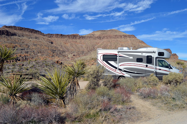
Death Valley – Day Two – Death Valley Headliners!


This is the the day we hit the high spots of Death Valley:

We drove south with beautiful views to a bumpy dirt road for a short ½ mile to get to Devil's Golf Course – rough textured salt crystals mixed with hardened mud runs across the entire valley floor in the area. The valley's original lake evaporated 2,000 years ago and salt crystals were left. They are sharp and difficult to walk among and looks and feels otherwordly.


Devil's Golf Course

Closeup of Devil's Golf Course


That little white sign near the top of the cliff is Sea Level
Next up was Badwater Basin, the lowest spot in the United States at 282' below sea level. We walked on the salt flats that look like slushy sleet/snow, but is simple table salt! 
Amazing patterns in the salt


Love the little "hairs" on the crystals

Back north to drive the fabulous Artists Drive with cliffs in pinks, greens, ochre, and buff. We sat at the Artists Palette viewpoint for sunset, where we enjoyed alpenglow on the peaks.


Back to the campground and yay! we have electricity. Fantastic day.


Death Valley - First Full Day


Our first night in Death Valley, we drove 20 miles southeast to Dante's Viewpoint to enjoy the sunset from over a mile high over the Valley. The bottom of the valley looks like a painting of random white smears.
Floor of Death Valley as viewed from Dante's Viewpoint, over 1 mile high.


Our first full day in Death Valley, we woke to a cold (42 degrees) but sunny morning. Our first experience was to visit the Harmony Borax Works where a Ranger gave a talk about the 20 mule team wagon trains that hauled the scraped borax to the Kelso Depot about 100 miles away – where we visited in the Mojave Desert. The site had a few remnants of the processing plant, employee company homes and a couple of the huge wagons and its water car. The trains averaged about 2 miles an hour up from the below sea level of the valley up through the pass, braking down the other side and through the desert. They hired Chinese to scrape the borax off the surface of the bottom of the valley and they were paid $1.58 per day, less their lodging and food. The borax operation only lasted about 5 years in Death Valley.
Two 


We then drove an hour north to the Ubehebe Crater – a fantastic steam-exploded volcano, exposing multicolored rock.

Next was the Mesquite sand dunes for a fabulous sunset.


We stayed near the dunes at Stovepipe Wells, again without electric. Jack's battery pack we bought easily handled his C-pap, but our batteries cannot handle running the propane fired furnace all night (needs electricity for the fan), so sleeping without heat, and running the furnace once in the morning to get temps up from low 40's to 70. Definitely not our preferred way to camp – we are “Glampers.”


Death Valley - The Prequel


We have so much to post about Death Valley area, I am doing it installments.  Here is the first:

After our stay in Mojave without hookups, and anticipating going to Death Valley for a few days without hookups, we decided sidetrack to a real town where we could stock up on supplies at a real grocery store and enjoy the luxury of unlimited electricity and water. We chose Pahrump, Nevada, just over the California state line. We shopped at a nice Albertson's (similar to Publix) and they even had a Walmart! Civilization!!!

Some beautiful desert scenery with Pahrump in the valley between the Spring Mountains on the East and Nopah Range Mountains on the West. It is only 50 miles from Vegas and is a popular spot for snowbirders.


We drove northwest out of Pahrump to a small isolated corner of Death Valley National Park in the Ash Meadows Preserve in Nevada. The Ash Meadows National Wildlife Refuge is a unique area of the desert with wetlands from springs that pop up from the underground river and aquifer in the area. We struggled on a 15 mile dusty, rutted dirt road into the Refuge and stopped at the Visitor Center to find out about the Preserve's history and plants and animals. Luckily, the area was saved from a developer's destructive plan to build an entire city here. Our prime stop was the portion of Death Valley National Park called Devil's Hole. It is just a bottomless hole with a massive underground cave system and is home to one of the rarest creatures on the planet – Devil's Hole Pupfish, and beautiful turqoise blue fish about 1" long. Although various types of pupfish are numerous and found throughout the southwest, these particular pupfish are unique to this hole in the ground and are protected. The Supreme Court ruled that water mining (yes, it's a thing) must not exceed a certain limit to ensure the water level on a ledge in the hole is sufficient to sustain the pupfish. 

Interestingly, the water in the hole will slosh like water in a bathtub when an earthquake hits – not just here in California, but any major quake in the world! It certainly isn't much to look at, but was an interesting stop.
Yes, another miserable dirt road - Li'l Guy is filthy and not happy.
 Yes,
That slit in the rocks is the Devil's Hole.  The funnel-looking things are put there for one month in the summer and one month in the winter to measure the amount of rock debris that goes into the Hole to ensure the Pupfish have enough oxygen and to check for contaminants.


We continued west through the Funeral Mountains and down into Death Valley. I'm not sure what I expected Death Valley to be and expected the low desert valley, but I did not anticipate the fantastically shaped and colored rugged hills and mountains. Around each bend as we entered from the East, we said ooohh and wow! Be prepared for lots of photos of really big rocks.


We drove to the main headquarters of the park around Furnace Creek, about 190' below sea level, stopped at the campground to get a site, but without electricity. The only night we could get a site with electric was Tuesday and this was Sunday. Lunch, a quick nap, and a stop at the Visitor's Center. Death Valley received it's name from a pioneer whose wagon train who after climbing up into the mountains in the West, exclaimed, good bye, Death Valley!
The Inn at the Oasis complex in Furnace Creek.

The sun sets early here – around 5pm and the desert gets cold at night. We spent a chilly night, woke to a beautiful sunny day and planned out the next couple of days in Death Valley.  Stay tuned.


Calico Ghost Town and Mojave Desert Preserve


We spent a couple of days in Barstow – the last significant California town before Mojave Desert Preserve and Death Valley National Park. Just north of town, we drove five miles over a washboard dirt road to Rainbow Basin Natural Area. I hiked a bit into the canyon, and it is a bit eerie walking in the sandy wash being able to reach out and touch both sides of the rock canyon walls. Not as colorful as others we have seen, but was a nice little walk. There was a scenic road tour, but it was too sandy and narrow for RVs and trucks.

We stayed the night at Calico Ghost Town Campground, about 10 miles north of Barstow. It was difficult finding a level site as it was on the side of a mountain, but was a quiet place to spend the night with only a few other campers in the whole campground. 

Sunrise in Calico Ghost Town

After a beautiful mountain sunrise, we headed to the Ghost Town – abandoned in the late 1800's when silver prices dropped precipitously. The town was “saved” by Walter Knott, of Knott's Berry Farm fame in the early 1950's and donated to the county in the 1960s. The town had a high population of just under 2,000 and is a mixture of original buildings and replicas. We spent a couple of hours visiting the shops and walking around the area.
Calico Main Street (the only street)


Maggie Silver Mine

Bottle House


Mountains with unusual faults in Calico Ghost Town


Leaving there, we headed back east to tour the Mojave Desert Preserve. This preserve is part of the great Mojave Dessert that spans four states – Arizona, California, Nevada and Utah. As we drove across the desert, we started climbing in elevation, and when we got to about 1500', we began to see thousands of Joshua trees. They call it a “forest” but it certainly is not what we think of in the East when we think of forest. We drove through huge black and reddish volcanic rock deposits and over a pass, then down into Kelso depot. This had been a major railroad staging point for WWII supplies with a beautiful Spanish mission style building. The original eating counter is there and is the visitor center for the Preserve. We watched a movie about the seasons, wildlife, and plants in the desert.

Kelso Depot - the only viable building in town run by the Bureau of Land Management

The original eating counter, now a gift shop

The ranger told us we could easily make it on a dirt road to the campground which was 20 miles away, instead of going around on the paved road which made it 64 miles. Uh. Terrible road – deeply rutted in places, sandy in others, and then the horrendous washbooard when not rutted or sandy. Took us about the same time as if we had taken the long route, but we did make it without incident and got ourselves a campsite in the no hookup campground. A few folks were here, but not many. At dusk, we spotted a bobcat just outside our window, but too dark and he was moving steadily, so I didn't get a photo.
Joshua Tree Forest

Bare bones campsite in the mountains of Mojave Desert Preserve

View from our campsite

Kelso Sand Dunes in Mojave Desert Preserve

Volcanic Cinder cones in Mojave Desert Preserve

We ventured outside after dark to try our night vision skills in this dark sky area, but it was just too cold to sit waiting for our eyes to adjust. We got on our way to finish the paved route south through the park, enjoying more Joshua trees, rugged mountains and did sight a mule deer, but no endangered desert tortoises, which are indigenous here, We drove west on I-40 to Baker, to fill up with fuel at $4.65/gallon! Yikes. Then headed north towards Death Valley. Some beautiful scenery along the way.
World's largest thermometer in Baker, California


We had planned on stopping in a small town of Tecopa, but when we got there, paid for our site, we found there is no fresh water in the town. They do have mineral springs and their mineral pools looked popular, but a bit dilapidated and a large, mostly dry lake bed of white salt.  Got a refund and drove 10 miles up the road to another small town called Shoshone and got a site with electric, water and a dump. We needed full service before heading into Death Valley where we could not get a serviced site until Tuesday. They do have gas stations in these towns, but not grocery stores and absolutely no cellphone service. This part of California is certainly not what we think of as Southern California - more like rural Nevada, Utah, Arizona.  How do they live here???

Eating dinner, we were treated to an earthquake – just a gentle shaking, as if someone were pushing on the side of the RV, but very noticeable. Woke to yet another glorious sunrise with clear skies.