Last Days in Nova Scotia

We visited the Glenora Distillery on the west coast of Cape Breton where Canada's only single malt whiskey is made. We found out that they cannot call it Scotch because only whiskey made in Scotland can be called Scotch. We toured the distillery to find out how they make the whiskey, tasted a small sample and walked the pretty grounds of the Inn that adjoins the distillery.


After leaving Cape Breton, we returned to the Fundy coast area to view the Joggins Fossil Cliffs - a great museum about the massive fossil finds in this area. We had bypassed this area on the way into Nova Scotia because we had to get to Halifax for our reservations at the Royal International Tatoo on Canada Day.


The weather wasn't going to cooperate for the next several days, so we decided to head back down to Maine and take our time going to Charlie's through the back roads of Maine, New Hampshire, Vermont and New York.

In Maine, we stopped at Nervous Nellies Jellies and Jams. This is also the home of Peter Beirit, the sculptor of our backyard Alligator. We needed to pick up a replacement section for the Alligator that the termites had decided to have for dinner. While there, we toured some of his other sculptures - a little different, eh? (See, we really did learn 'Canadian'.)

Louisbourg Playhouse

After visiting the fortress yesterday, we took a nap before going out to dinner at a local family restaurant. We had a nice dinner (lobster roll for me and pizza fingers for Jack), then walked over to the Louisbourg Playhouse to take in an evening billed as "lyrics and laughter." It is a small playhouse and featured a band that plays the local Cape Breton music of the Scots and the Acadians with songs about Cape Breton. It was a great evening, filled with the sounds of fiddles, guitars, keyboard, gifted vocals and hilarious comedy.

Louisbourg


We spent the day visiting the Louisbourg fortress. We learned that it was not a fort (military only), but a fortress because it was a fortified town. The French built it in the mid 1700s to protect the hugely profitable salt cod industry. There were some complicated historical treaties that traded the fortress back and forth between the French and the British, with the British finally winning the fort and destroying the surrounding fort walls. The flying debris along with the vibrations severely damaged many of the homes and the town eventually died away with time slowly turning the town to rubble.
The Canadian government has over 1,000,000 documents from the time regarding the homes, the fortifications, and facts about daily life that were obtained from Quebec and France - apparently the French Empire was a huge bureaucracy requiring tons of paperwork that served them well when reconstruction began. The size and number of the reconstructed buildings are huge - all done exactly to the original specifications - many of them on original foundations. Costumed interpreters are in every building and throughout the town. They stay in character and explain about daily life from the points of views of soldiers, officers, traders, sailors, inkeepers, fishermen, children, gardeners, servants, wives, blacksmiths, etc.
We spent more than five hours here learning the history and exploring the buildings. Now we understand why this is Canada's Park System's Crown Jewel. This weekend more than 1,000 re-enactors will be here to camp out and be part of a major celebration regarding the second seige when the fortress fell to the British for the last time.
Lots more photos at the Shutterfly website listed at the right.

Cheticamp

We finished the portion of the Cabot Trail that goes through the Cape Breton National Highland Park while the weather was good. We stopped for the night in Cheticamp - an Acadian town on the west coast of Cape Breton.


The rain arrived, as expected during the night, so we decided to check out some indoor places of interest. Monday morning we stopped at a local Boulangerie (bakery) and bought the most delicious croissants, cookies, and crusty rolls.


Cheticamp is one of the Acadian famous homes of hooked rugs. We stopped at a museum and saw the most amazing rugs. Some were floral, but the outstanding ones were portraits of US Presidents (many were presented to the White House), massive rugs with religious themes and landscapes.


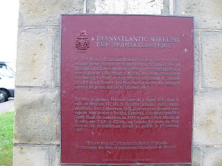
We then took advantage of the cloudy weather to drive across Cape Breton to the Marconi Trail and down to Louisbourg. We made a stop at the Marconi museum that outlined Marconi's success in establishing the first trans-Atlantic radio contact. There was a guy there operating the ham radio using Morse Code - Jack and he talked quite a while and had a ball.


On our way, we spotted this wood pile that was done in the round!


After the Marconi museum, we tried to visit a Miner's Museum, but it was too late in the day. We drove the 45 minutes down to Louisbourg, home of Canada's Park's "crown jewel" which is a huge recreation of a fort. AAA recommends reserving an entire day to see the park, so that is what we plan to do tomorrow. Luckily, the hurricane that is brushing the coast is going a little further out to sea, so we will probably have light rain, but no massive winds or rain.

Cabot Trail Drive

The weather never cleared on Saturday, so we relaxed, visited craft stores, and worked on the internet at the Lodge. After dinner, the rain stopped long enough for us to hike out to the ocean from the campground and enjoyed watching the waves and the tide coming in.
Sunday morning dawned clear with brilliant blue skies, so we headed out to drive the Cabot Trail. The Cabot Trail travels along the coast and then cuts across the top of Cape Breton through beautiful valleys and across multiple mountains before heading back down the west coast of Cape Breton.
We stopped at a beatiful beach with great waves for body surfing or boogy-boarding. The water was warm for this part of the world - 60's and the air temp was only 73, but folks were there sunning in their bathing suits and enjoying the water. Jack watched longingly for quite a while - unfortunately, we didn't bring the boogy boards.We stopped for lunch at a picnic area overlooking the ocean with a very small beach - a beautiful spot. At the northernmost tip of Cape Breton, there is a side road (10 miles of it are unpaved) to a small community called Meat Cove that we took with the idea we might camp on the ocean. It was pretty, but it was early afternoon and the weather the next day was to return to rain, so we decided to continue on a finish the portion of the Cabot Trail that goes through the scenic Cape Breton Highlands National Park. We did a number of hikes and viewpoints along the Trail - a fabulous drive and a wonderful day.

Bluff Hike at Keltic Lodge

We hiked a couple miles out to the end of a bluff at the start of the Cabot Trail. The rocky coastline of the Atlantic had pounding waves and lots of birds - a great hike. We had a great dinner at a locals' restaurant - hard to find up here as tourism is King.

Today the weather calls for rain all morning (maybe all day?), so we're going to head down to the Keltic Lodge's lobby to get internet access and catch up on the blog. If it clears later today, we start driving the Cabot Trail; otherwise we'll stay put until tomorrow.

Cape Breton Highlands National Park

At the entrance to the Cape Breton Highlands National Park and the one end of the Cabot Trail, is the Keltic Lodge and the Highlands Golf Course - one of the top 100 course according to Golf Digest. We played with a couple of guys from the States who were here with their wives on a bicycling caravan. The course is beautiful and we played okay, but it wasn't as spectacular as we expected. It had lots of huge par 5's and every hole had a name....

Cape Breton

We crossed the Canso Strait into Cape Breton and stopped at the visitor center to find out the extended weather forecast. We were told to drive the famous Cabot Trail at the top of Cape Breton only if the weather was clear. We also want to play golf at the Highlands Links in the same area - so, we needed at least 3 days of good weather. The best we could figure, we could get 3 good days out of the next 4, so we headed directly to the Cabot Trail.

We made a stop at Alexander Graham Bell's museum. He was a scotsman by birth, an American citizen, but spent much of his life in Canada in a mansion on a bluff overlooking a beautiful bay. We learned that in addition to the telephone, he was very involved with flying machines, genetics, hovercraft and teaching the deaf (he taught Helen Keller).


Sherbrooke Village

We stopped at a small village called Sherbrooke that has been preserved and restored. We've been to other colonial villages where the buildings are brought in from other areas, restored and assembled into a community, but this village is exactly the same as it was. The government started with a few homes on one street, and as private owners sold them over the years, the government bought them, preserved and/or restored and continued to "grow" the village. Buildings included the blacksmith, the general store, private residences of the rich and not-so-rich, etc.

We had our photo taken as an ambrotype - this process is similar to the old tintypes, but the photo on is etched on glass.

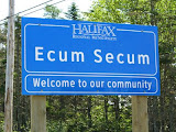
After leaving Sherbrooke, we completed the Marine Drive on the Eastern Shore, driving through some very interesting named towns.

Eastern Shore Observations

We noticed a few things that seem common throughout Nova Scotia - fishing boats, lobster traps, massive amounts of stacked firewood, pretty white churches, and laundry drying on clotheslines.
The temps have been very comfortable - usually 70s during the day and low 60s in the evenings.

Eastern Shore Marine Drive

We continued our drive along the Eastern Shore. The road in most spots was horrible - we swayed, rolled, bounced, banged around a lot. We met some folks from southern NJ and the one guy said his stomach was upset from all the swaying! The coastline is very pretty with lots of small coves and bays and small islands just offshore.

Peggy's Cove

This morning dawned fog and rain showers. We tried a hike around the harbor where we were staying (Glen Margaret), but we took a wrong turn on the trail and ended up in someone's backyard.....we walked back to the campground along the road. We got our exercise in, but we never did see the nice view of the harbor.
We drove to Peggy's Cove. This is one of the most photographed "quaint fishing villages" of Nova Scotia. It is about one hour from Halifax and was absolutely mobbed by tourists - we counted 10 buses in the parking lot - all from big cruiseships docking in Halifax for the day. It would have been a pretty village - sign said population of 40 - tourists must be have been more than a thousand. Fortunately for us, we had visited some of the less well-known quaint fishing villages before this.
We took a few photographs and drove back into downtown Halifax to visit Pier 21 - Canada's version of Ellis Island. The Canadian immigration story is very different than the American. Canada had very limited immigration until the 1920s, whereas our immigrations started in the late 1800s. Canada's largest immigration involved war brides after WWII and some cold war refugees. The museum had an excellent holographic 3-D type multimedia presentation and a guided tour that explained the Canadian immigration experience really well.
We stopped along the Eastern Shore (yeah - Canadians refer to the beach as Shore, just like us folks from New Jersey) to stay in a campground on a lake - a pretty spot.

Lunenberg

We stopped to explore the ship-building town of Lunenberg on the South Shore. We saw an interesting demonstration of how they actually launch a new ship and visited a museum that describes the fishing industry, boat-building and the history of the town. The museum included two boats at the dock - one a fishing trawler and one a ship from the 30s that salted the fish as they caught them.

The town is pretty with lots of shops and galleries to explore. The historic downtown and wharf areas are designated a UNESCO World Heritage Site.

Kejimkujik National park

Kejimkujik National Park is a beautiful lake wilderness area in the center of Nova Scotia. We stayed in the Park campground (no electric, water or sewer-again - boy are we getting brave) and spent half a day kayaking around the lake and visiting small bays and islands. We spotted some wildlife - cute ducklings and a deer grazing along the riverbank. We also found a beaver dam in one of the little bays, but never did see any beaver.
At the end of the day after all the paddling and hiking, we relaxed around our campfire - one of our best days so far in Canada.