 |
| Ocean view from our campsite in L'Anse au Clair |
Just for the record, it is pronounced LabraDOR. So they say newfoundLAND and labraDOR, emphasis on final syllable.
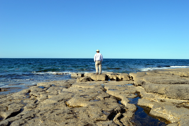
Anyway.....here we are! We woke to a mix of sun and clouds and realized that our campsite had an ocean view - not oceanfront, but we could glimpse the Strait of Belle Isle that runs between Newfoundland and Labrador.
 |
| Villages clustered around the bays |
 |
| Modern wooden bridges |
We headed north on the eastern coast through a few small towns, originally fishing villages, many with French names...L'anse au Clair, L'anse Amour, L'anse au Loup on up to Red Bay - a UNESCO World Heritage site. The Basques (region that sits between France and Spain) were the primary folks in the whaling business. Their Labrador encampment that they used in spring and fall in the 1500's to hunt whales was here and they have built two small museums to document the history and artifacts.
 |
| Early archaic aboriginal gravesite of a child |
They found a whaling ship in the harbor fully preserved and it was interesting to learn how the maritime archaelogists do their work. We stayed the night in a "campground" that was just a parking area next to a gas station. It wasn't bad because this is not a modern station that is open 24/7 with dozens of pumps - just a single pump out front, no credit cards, and the place closes at 9pm and does not open until 8am. This is the only station in the town - life would certainly be different here - more like it was in 1950's rural America.
 |
| Replica of ship they left at the bottom of the bay after cataloging each piece |
 |
| Whale oil was the primary lighting fuel in Europe |
 |
| Red Bay Lighthouse |
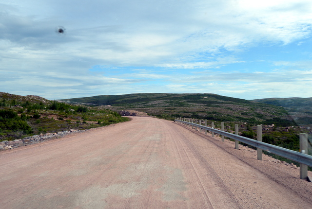
Jack has spoken with quite a few folks about the Trans-Labrador Highway (TLH) and only one warned us off completely - most said it isn't bad for a mostly gravel road as long as it isn't after a hard rain when the potholes get big enough to swallow a small car. So, we decided with Jack's very reluctant okay to "do" the TLH. After filling our tank and getting a loaner satellite phone from the gas station because there is no cellphone service for 300 miles, we headed northwest on the infamous TLH. The road was finished in 2009, allowing folks in the interior towns their access to the world by car.

First 25 miles were horrible - medium sized potholes and washboard that was hard to avoid, even using both sides of the road, but managed to do about 35-40 mph. No traffic at all, but the scenery was beautiful - mountains covered evergreens from the dark, dark green with lots of black fungus to a feathery light green and every shade in between and stunning lakes with lots of treed islands. There is a light yellow/green lichen that grows on the rocks that looks like flowers from a distance. Very pretty.
 |
| Only 600+ kms to go |
The road eventually smoothed out and we were cruising at 50 mph with occasional 3-5 mile stretches of nastiness. After 300 miles, we reached the first town Happy Valley-Goose Bay exhausted and very happy that the bulk of the driving on gravel was done. We stopped for fuel and three young kids were running the station - under 15 year's old. They tried to open one of our bays, looking to pump the diesel and we had to show them where our tank is. No adults anywhere - interesting!
 |
| Sled (upside down with runners up) used to bring firewood out of the forest to the roadside |
 |
| Cannot imagine how dangerous it would be drive this road on a motorcycle |
 |
| One lane bridges |
 |
| This warning was for 410 km fuel desert |
 |
| Road workers - notice the headnets for the blackflies and mosquitoes |
 |
| We did not see any moose |
 |
| The dust turned to mud in a light drizzling rain |
We grabbed a take-out pizza before heading to the only campground in town, only to find it had gone out of business two days before! So, we asked around and ended up parking with a few other RVs next to the visitor center where they even had a couple of 15-amp outlets. Worked out great.
 |
| These powerlines are never far from the road coming from Churchill Falls |
Woke to beautiful blue skies and looking forward to driving a paved road for another 200 miles to the next town, Churchill Falls where one of the largest underground hydroelectric plants in the world is located. We headed into town to get fuel and it was obviously a company town - everything is cookie cutter prefab homes and only one fuel station. During the week, tours are available of the facility, but we have seen this type of thing before in the huge dams on the Colorado River, so decided to push another 100 miles to Labrador City -- the end of the TLH.
The road was excellent, but the drive became pretty boring with few hills, solid evergreens lining the road, but occasionally broken up with beautiful lakes.
 |
| Company town housing |
 |
| The river used to careem down these rocks before being diverted for the dam |
 |
| The light yellow/green lichen adds color |
 |
| And the road goes on and on and on |
We pulled into Labrador City around 5:30 and stopped to drop off the satellite phone that thankfully, we did not need. Looking for the only campground, we stopped at the visitor center for directions as they were locking the doors and it turns out they had hookups right on the side of the building, so we stayed here the night.
We may stay here another day to have the brakes checked, do some laundry and general maintenance. As we head into Quebec province, we have to decide on which route to take back into the States. The most direct way is to stay in the Quebec province and drop down into Vermont, BUT we are missing American TV news, internet and cellphone availability so we would like to get into the States as early as possible. Hmmm, decisions, decisions. This one will be Jack's call.


